Mapping tools to assist the public in drawing maps are listed below. There are different tools for different purposes, and different tools for different levels of technical skill and interest.
A variety of map-drawing tools are available:
1. Paper-only maps for those without internet access or who prefer paper.
Tools needed:
2. Paper maps with a Microsoft Excel spreadsheet to calculate population totals.
Tools needed:
-
- Public Participation Kit – Paper Map w/ Population ID#s (in English or Spanish)
- Public Participation Kit – Excel Spreadsheet (in English or Spanish)
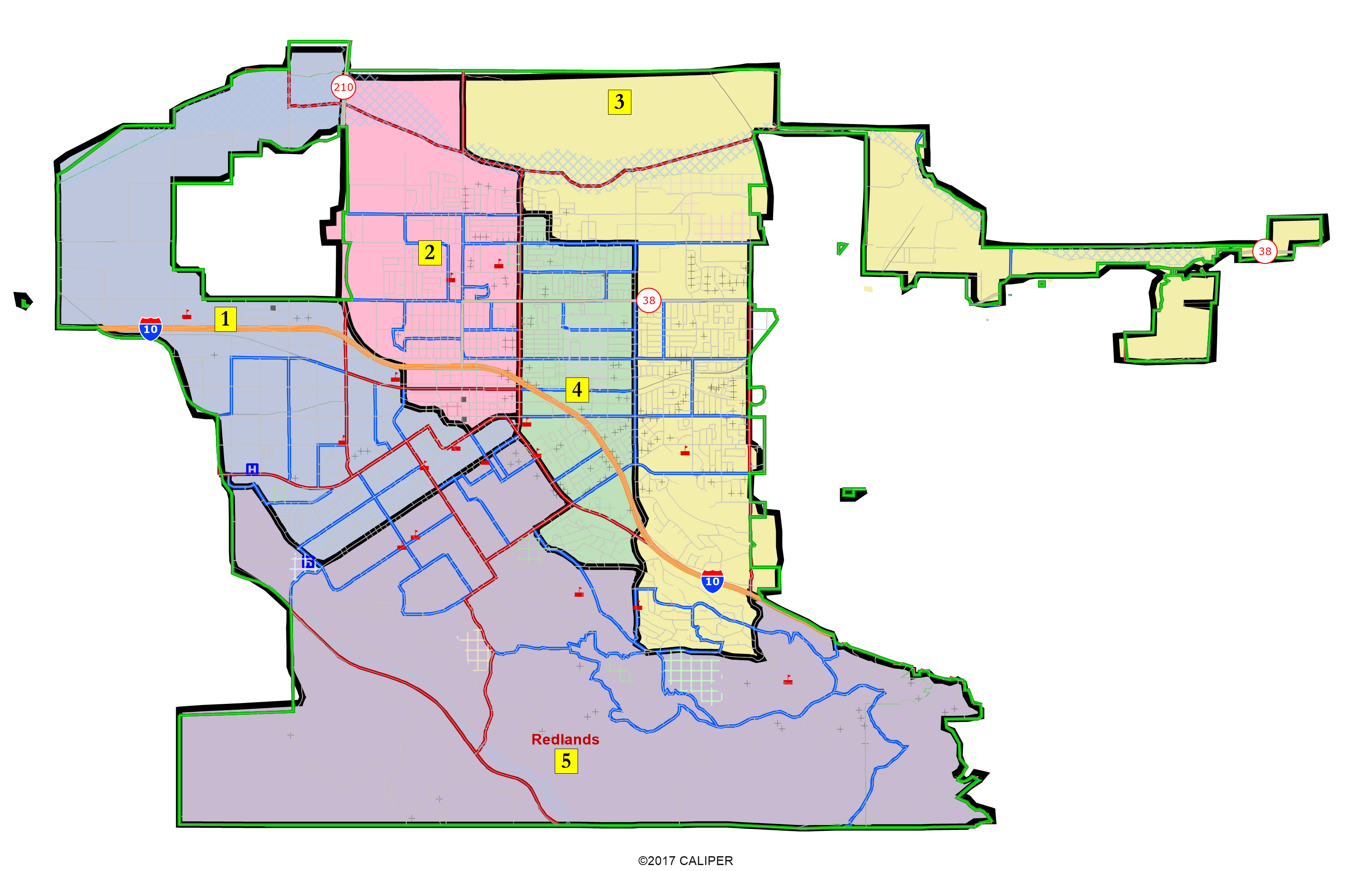
- Current District Map Link
- Current District Map Demographics
3. Interactive Review Map to review, analyze, and compare maps, not to create them. Zoom in and out on map boundaries, view population counts/ID#s, and view draft maps (once the draft maps are released). Similar to Google Maps in ease of use.
Tools needed: Interactive Review Map
Submit maps to redistricting@cityofredlands.org. After you submit your map, the demographic consultants will generate the population and other demographic details for your proposed map. Maps can be viewed on the Draft Maps page.
It is helpful if you submit written comments with your map describing how your map was drawn to meet the required criteria. An example of this would be describing the specific neighborhoods or communities of interest that are kept within a single district.